RED SISMOLÓGICA NACIONAL (R.S.N COSTA RICA No. 90
Anuncio
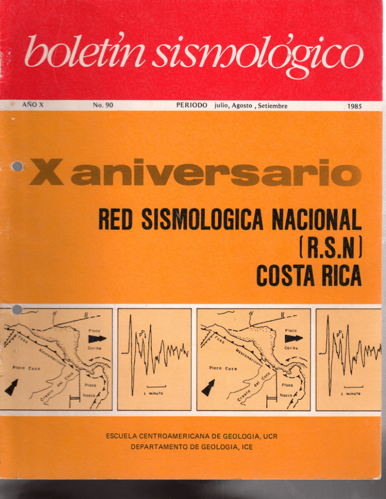
ASIOX No. 90 PERIODO julio, Agosto , Setiembre 1985 m RED SISMOLÓGICA NACIONAL (R.S.N COSTA RICA mingto ESCUELA CENTROAMERICANA DE GEOLOGÍA, UCR DEPARTAMENTO DE GEOLOGÍA, ICE f ESTACIÓN SISMOLÓGICA ACELEROGRAFO. RED SISMOLÓGICA NACIONAL. I.C.E.-U.C.R. W.8.C Datos de las estaciones de la Red Sismológica Nacional (RSN): ICE-UCR ESTACIÓN U. de Costa Rica La Lucha 2 Volcán Poás 2 San Ramón Volcán Irazú Buvis Quepos Chiripa Limón Adams Vista del Mar Fortuna Jicaral CÓDIGO LONGITUD LATITUD 84203.25' 84200.18' 84214.12' 84226.89' 83249.83' 83245.47' 84209.75' 84254.63' 83202.10' 83210.23! 85237.42' 84241.52' 85206.98' 9256.35' 9244.53' 10211.4T 10204.95' 9258.85' 9233.42' 9225.52' 10226.38' 10200.30' 8238.93' 10207.50' 10228.00' 9251.02' SJS LCR2 VPS SRA ICR BUS QCR AR6 LIO ACR VCR FOR JCR ELEVACIÓN 1196 m 1730 m 2570 m 1160 m 3306 m 3400 m 50 m 1020 m 62 m 100 m 800 m 500 m 582 m Personal de Sismología Sección Sismología, Vulcanología y Exploración Geofísica (UCR) Sismología e Ingeniería Sísmica (ICE) Coordinador Luis Diego Morales Guillermo Alvarado Especialista o Profesionales Walter Montero Ileana Boschini Alvaro Climent Asistentes de Laboratorio Wilfredo Rojas Ricardo Vega Harvey Herrera Marco Gallardo Edwin Olivares Asistentes de Invesitgación Rafael Barquero Gustavo Segura Ingenieros y Técnicos en Electrónica Luis Aguilar José M. Barrantes Guido Calvo Dirección Postal Sección de Sismología Vulcanología y Exploración Geofísica Escuela Centroamericana de Geología Apartado 35 Universidad de Costa Rica San José, Costa Rica Sección de Sismología e Ingeniería Sísmica Departamento de Geología Instituto Costarricense de Electricidad Apartado 10032 San José, Costa Rica ANTECEDENTES Y BREVE HISTORIA DE LA RED SISMOLÓGICA NACIONAL El presente boletín sismológico trimestral corresponde con el número delduodéciimo aniversario. Durante estos doce años, hemos publicado de manera periódica e ininterrumpida datos sismológicos de eventos locales y regionales, así como también de telesismos. La Escuela Centroamericana de Geología de la Universidad de Costa Rica (UCR), desde su creación en 1970, se preocupó por crear y desarrollar una Sección de Geofísica que incluye la Sismología, la Vulcanología y la Exploración Geofísica. Es así como, mediante el apoyo técnico y financiero de la Organización de Estados Americanos (OEA), de 197H a 1979 se instalo una red de cinco estaciones sismográficas permanentes y cinco portátiles, en el Valle Central de Costa Rica, y se logró la capacitación de personal, tanto a nivel técnico, como de posgrado. Posteriormente se ha contado con la valiosa ayuda del "Gobierno Japonés", a través de su Agencia de Cooperación Internacional (JICA), una de cuya donaciones es el Observatorio Sismológico de La Lucha, con tres componentes de período corto, medio y largo. Paralelamente, el Departamento de Geología del Instituto Costarricense de Electricidad (ICE), instaló una red sismográfica telemétrica de 10 estaciones de 197Ha 1978, para estudiar la sismicidad en el Proyecto Hidroeléctrico Arenal, y la actividad del Volcán Arenal. El desarrollo de nuevos proyectos hidroeléctricos o geotérmicos y la necesidad de vigilar las obras concluidas, ha llevado al ICE a continuar con la observación sismológica y volcánica de diferentes áreas del país. Es así como a partir de 1982 se desarrolló un proyecto de cooperación institucional (ICE-UCR), que integraba equipos, información, personal y optimizaba recursos, constituyéndose la Red Sismológica Nacional (RSN). En la actualidad, la RSN tiene un intenso programa de colaboración institucional, que mantiene en operación trece estaciones sismográficas, diez de ellas con enlaces a través de microondas y líneas telefónicas, con un centro de registro en el ICE. Se realiza investigación sismo-tectónica, vulcanológica y una auscultación de la sismicidad del territorio nacional, con arreglos sismográficos portátiles en los proyectos hidroeléctricos o geotérmicos, con divulgación nacional e internacional de la información obtenida y atención a los requerimientos del país en la previsión de desastres naturales. ANTECEDENTS AND BRIEF HISTORY 0£ THE NATIONAL SEISMOLOGICAL NETWORK The present quarterly seismological bulletin corresponde to that of its tenth anniversary. During these ten years, we have published seismological data of local and regional events, as well as of télese! sms . The Central American School of Geology of the University of Costa Rica(UCR) was concerned, from its begining in 1970, to créate and develop a Section of Geophysics which includes Seismology, Volcanology, and Geophysical Exploration. From 1974 to 1979, a network of fivepermanent and five portable seismographic stations was installed in the Central Valley of Costa Rica, and local personnel were trained at the technical and postgraduate levéis. This was possible with the technical and financial support of the Organization of American States (OAS). Later on, the kind support of the Government of Japan was received through its Agency for International Cooperation (JICA); one of its donations being the Seismological Observatory of La Lucha. This Observatory records the short, -eiium, and long period components. During the 197M--1978 period, the Department of Geology of the Costa Rican Institute of Electricity (ICE) installed a telemetric seismographic network of ten stations, in order to study the seismic activity in the área of the Arenal Kydroelectric Project and the activity of the Arenal Volcano. The development of new hydroelectric and geothermal project and the need to watch over the completed plants, induced ICE to continué with the seismological and volcanic observations of different regions of Costa Rica. In 1982, a project of cooperation was developed between UCR and ICE, which integrated equipment, information, and perscr.r.el, cptimizing resources and forming the National Seismological :"e-v::r!-: (RSN). At present, the RSN has an intensive program of institutional collaboration, which maintains in operation thirteen seismographic stations, ten of which are linked (through microwaves and telephone lines) to a recording center at ICE. Research seismo-tectonics, volcanology, and monitoring of the seismicity on of Costa Rica is made, taking into account the requirements of the country concerning the preventions of natural disasters. Disemmination of the information at national and international levéis is periodical and frequent. EXPLICACIÓN DE LOS DATOS El presente Boletín Sismológico Trimestral contiene la siguiente información: PARTE A: Localización y parámetros de todos los sismos locales registrados trimes_ tralmente por todas las estaciones de la Red Sismológica Nacional (RSN) y cuya magnitud es>2.5. PARTE B: La lectura de los tiempos de arribo para los eventos locales, registrados por RSN con M ^ 4.0, sismos regionales y telesismos, en las estaci£ nes LCR2, SJS, SRA, VPS2, ICR, BUS, LIO, QCR, ACR, JCR, VCR, y AR6 ya que éstas son, actualmente las que tienen sus respectivos códigos Ínter nacionales. 1 EST. Estación que registró el evento 2 FECHA Todas las fechas están reportadas en tiempo medio de ( Greenwich (TMG) TIEMPO Tiempo origen (Parte A) y tiempo arribo de las fases (Parte B), están dados en horas, minutos y segundos en TMG. FASE Una "i" o "e" precede el nombre de la fase para indicar el carácter del arribo, a) "i" (ímpetu), indica que el primer arribo fue impulsivo y la dirección del primer movimiento es evidente. b) "e" (emersio), indica un comienzo gradual en el cual la dirección del movimiento es dudosa. COM. Designa la componente (N, E o Z) del sismógrafo de la cual el tiempo de arribo fue medido. POL Polaridad, una C o una D representan un movimiento de compresión o dilatación respectivamente. Indicada especialmente para las fases designadas, con ímpetu (i). PER Si se trata de la estación LCR2 entonces se anota si el dato es de Período Corto (PC), Período Medio (PM) o Período Largo (PL). 8 PROF Indica la profundidad a que se produjo el foco del sismo. 9 RMS Indica el error medio estandard, que da como resultado la localización por computadora, a través del programa HYPO 71(Versión 1978) Datos de errores de la localización horizontal (H) y vertical (Z). 10. 11 12 13 ERH, ERZ Localización manual. COMENTARIO Indica si el epicentro es de sismos locales (con M ^ 4.0). Para telesismos o regionales, se utiliza el reporte de NEIS. Los regionales se refieren a sismos fuera de las zonas limítrofes de Costa Rica. Iteración: # de veces que se repite el proceso. PARTE A PARÁMETROS CALCULADOS DE SISMOS LOCALES CON M >= 2.5 JULIO/85 tt DÍA TIEMPO ORÍ 01 02 03 04 01 05 06 07 08 09 10 11 12 02 02 02 02 02 02 03 03 03 04 04 05 07 07 09 10 10 11 11 13 14 15 16 18 18 19 20 21 21 21 22 22 28 28 30 31 31 13 m 15 16 17 18 19 20 21 22 23 24 25 26 27 28 29 30 31 32 33 34 35 36 024643.26 025528.05 140423.07 170041.49 024643.26 225956.47 124110.95 144938.24 225007.40 113539.50 123216.00 131634.42 012230.54 105739.38 174237.98 080917.77 113349.13 111023.67 120246.60 031949 .13 123359.05 050106.50 140342.21 013553.82 152615.65 192738.85 195925.83 060901.62 135856.80 173626.37 042126.90 084901.20 082934.95 084638.89 202720.60 020146.98 075330.60 LAT N LONG U 09:17.18 09:11.24 09:32.79 09:41.92 09:17.18 09:35.21 09:47.45 09:28.91 09:12.72 83:57.35 84:05.61 85:15.91 85:13.71 83:57.35 85:10.07 83:51.36 83:37.32 83:58.49 84:00.28 83:58.24 84:01.07 84:26.22 83:36.78 83:01.62 84:20.49 83:59.89 84:53.83 84:53.48 83:42.77 83:11.75 83:42.00 84:10.98 83:47.24 85:35.15 84:50.91 84:03.34 84:39.00 84:38.55 84:06.04 83:35.32 84:49.25 84:36.27 84:33.21 83:32.14 84:22.32 84:32.38 09:04.07 09:57.01 09:09.83 08:41.10 09:34.29 08:15.54 09:29.39 09:12.32 09:39.89 09:38.06 09:02.23 10:23.90 08:39.00 10:09.11 09:12.93 10:10.20 09:17.54 09:47.03 09:30.51 09:27.93 09:34.04 09:26.88 09;35.54 08:52.45 09:05.46 08:24.02 09:56.98 09:25.01 PROF MAG GAP RMS ERZ I 34.0 12.4 14.5 31.2 34.0 02.6 55.2 14.2 15.0 14.8 06.5 26.0 36.4 06.6 39.7 35.4 30.8 14.7 15.8 32.7 62 . 2 30.0 4.3 8.9 24.9 2.5 286 261 300 301 286 289 142 322 220 232 165 324 238 182 347 169 223 225 231 174 247 *#* 198 190 304 223 131 220 225 151 177 219 282 264 276 143 188 .30 4.9 5.8 .47 7.5 7.0 .25 3.6 3.1 .19 8.0 4.1 .30 4.9 5.8 .30 8.2 7.9 .12 2.1 1.7 .23 3.1 1.9 .29 2.7 1.7 .25 6.3 11.2 .18 1.8 1.2 .08 2.5 8.4 .27 3.3 6.1 . 13 3.0 3,6 .20 35.0? 3.9 .31 1.9 1.9 .14 6.9 10.6 .22 3.4 5.6 .17 5.8 7.4 .26 2.7 1.9 .34 9.0 6.6 **# fli^fli *** .45 2.4 2.4 .72 5.5 8.0 .54 5.2 3.1 .24 2.8 4.3 .36 4.0 2.3 .45 3.5 1.9 .30 2.2 4.2 .33 3.0 2.9 .22 6.4 3.6 .97 8.2 25.2 .15 4.8 15.7 .36 2.0 2.5 .30 4.8 1.7 .22 2.6 2.3 .34 2.8 6.4 3 8 4 3 3 5 5 4 3 4 4 3 5 6 6 4 4 4 5 4 6 * 5 8 3 4 2 5 5 4 4 4 5 ó 4 4 4 68.8 39.9 02.8 44.2 14.5 26.9 14.8 6.4 24.1 56.5 31.26 4.3 2.9 2.6 2.6 4.3 2.8 3.4 2.6 3.1 2.8 2.5 3.1 3.8 2.5 3.2 2.7 2*6 2.5 2.6 4.2 4.3 2.8 2.7 2.9 3.6 2.8 2.5 2.7 2.5 2.6 2.5 2.6 3.4 3.0 2.9 3.1 3.3 ERH AGOSTO/85 * DÍA 01 02 03 04 05 06 07 08 09 10 11 12 13 14 03 03 04 05 05 06 06 06 07 07 07 11 11 14 15 16 18 19 19 23 24 27 27 28 29 29 31 15 16 17 18 19 20 21 22 23 24 25 26 27 TIEMPO ORÍ 054023.90 110515.60 080824.90 012851.29 014728.10 211501.90 232638.20 233715.20 021042.70 022218.70 071311.87 071908.90 173636.40 160010.70 210122.14 214857.16 023548.20 064004.20 194409.00 160925.20 133231.94 220629.09 232211.30 003817.08 041654.44 145012.06 202215.40 LAT N 09:25.14 08:39.34 09:40.92 09:25.12 10:04.51 08:55.71 08:43.65 08:47.34 08:44.81 08:43.96 08:36.55 10:23.79 09:32.97 10:02.95 09:37.48 08:18.38 09:40.02 09:50.70 09:37.74 09:31.85 09:45.00 09:18.40 09:33.20 09:36.98 09:35.85 09:35.38 08:17.41 LONG U PROF HAG 83:36.28 82:51.02 84:49.19 83:55.08 84:12.83 84:13.75 83:29.50 83:28.61 83:31.13 83:35.97 83:35.18 83:08.84 83:39.79 84:31.95 83:40.44 82:05.74 84:32.59 84:06.30 83:48.72 83:39.75 83:07.00 84:57.20 84:18.36 83:38.42 83:41.55 83:37.16 82:33.84 12.1 09.6 12.7 45.7 72.8 32.1 20.0 2.5 25.5 20.2 41.9 39.3 11.1 49.6 05.1 30.0 23.8 5.9 5.3 15.7 **** 27.5 31.8 11.2 05.6 05.8 01.3 2.5 3.6 2.7 3.2 2.7 3.8 4.3 3.0 3.8 2.8 2.6 3.6 2.5 2.5 3.8 3.9 2.5 2.6 3.6 2.5 2.5 3.4 2.7 2.8 2.9 2.9 3.6 GAP RMS 308 350 203 239 117 280 320 320 319 331 345 304 296 173 254 344 190 200 *** 171 *** 233 236 182 258 102 337 ERH ERZ I .40 3.5 2.5 .29 10.5 5.1 .51 2.6 4.0 .38 4.3 3.4 .40 3.8 2.9 .16 2.4 1.9 .45 5.8 8.3 .56 7.6 6.4 .40 4.9 2.9 .54 5.7 73.8 .08 *** *** .66 6.1 2.5 .18 2.5 4.3 .37 2.7 4.6 .36 4.0 7.8 1.50 0.3 *** .37 2.8 9.9 .22 1.4 0.8 .31 2.6 2.5 .63 8.5 17.4 *** *** ^ v^ .49 4.5 7.3 .49 6.5 10.1 .62 4.6 5.6 .32 4.8 4.1 .64 2.9 2.9 .20 10.0 6.4 4 ó 4 3 3 3 4 4 4 5 5 4 4 3 * 4 4 * * 5 * 4 4 3 4 3 7 J SETIEMBRE/85 tt DÍA 01 02 03 OH 05 06 07 08 09 10 11 12 13 01 02 03 03 03 OM 05 07 09 11 12 12 13 16 17 18 19 20 21 22 23 24 25 26 27 28 29 30 31 32 33 34 14 15 16 17 18 20 22 25 25 25 25 25 25 26 26 26 27 29 29 m m 15 m X* TIEMPO ORÍ 232556.10 044593.00 002841.32 100209.87 222812.10 224634.80 223417.19 145316.00 114410.42 151058.90 062355.09 160318.40 210955.80 032853.70 201545.60 233638.00 230437.60 100259.89 001335.69 113449.43 105301.60 .1.14049.40 120954.30 122227.60 152514.20 152923.30 171710.50 233638.40 043913.50 084842.50 131714.20 194114.90 000151.30 202730.30 LAT N 09533.12 08:53.17 iOsOó.ói 09:58.95 09 s 33. 98 10:10.90 09:34.10 09:19.22 09:44.63 09:48.54 07:57.01 09:32.24 09:44.63 10:41.64 09:32.57 09:43.54 09:33.94 09:03.63 09:28.79 09:42.47 09:50.00 10:23.26 09:02.63 09:10.00 09:05.87 09:01.84 09:05.06 08:58.64 09:03.00 09:17.46 09:03.00 09:01.17 08:51.63 09:06.12 LONG U PROF MAG GAP RMS ERH ERZ I 83:38.51 17.3 84:01.52 02.5 85:55.32 28.0 83:43.90 45.0 84:13.03 33.6 86:32.96 15.0 83:41.09 05.9 84:07.74 23.4 84:30.01 44.2 84:01.56 06.8 83:01.43 30.0 84:30.65 30.0 84:16.88 56.2 83:30.84 57.0 84:32.06 09.9 84:01.56 06.8 84:58.00 36.3 83:33.03 30.0 83:41.63 13.6 84:44.80 07.9 85:02.00 30.0 83:15.61 33.1 84:02.57 31.0 84:18.50 *### 84:01.57 23.1 84:07.14 08.4 84:00.02 38.9 84:06.17 30.0 84 : 1 1 . 5020.0 83:46.14 15.7 84:06.50 **#* 84:04.91 33.3 83:26.76 31.5 84:03.88 05.0 2.5 2.7 4.7 2.5 2.6 3.6 3.7 2.6 3.5 3.4 3.2 2.5 2.5 3.0 2.7 2.3 3.7 3.3 2.6 2.9 2.6 3.0 5.2 2.9 4.2 3.1 2.5 3.1 3.6 3.3 2.5 2.9 3.1 2.6 195 253 250 174 156 338 208 241 176 160 338 174 143 339 209 180 215 159 163 192 #*# 265 214 ### 187 198 278 280 ### 180 **# 278 173 189 .66 .83 .03 .94 .50 .26 .19 .49 .35 .22 .94 .52 .34 .39 .41 .22 .22 .39 .55 .48 ### .32 .28 ### .31 .38 .28 .47 ### .11 7.0 12.4 0.3 37.5 2.9 8.0 3.5 5.0 6.8 6.3 41.6 3.0 3.0 36.0 2.5 6.3 2.3 7.8 6.9 2.4 **# 2.7 3.4 *** 2.1 2.5 2.6 5.9 #*# 1.9 •* *P *P *** .51 6.4 ,46 11.2 .61 3.1 28.0 14.9 4 4 4 3 4 6 4 5 3 4 4 3 2 4 3 4 4 3 3 4 * 6 4 * 4 3 4 3 * 4 « 4 0.2 9.3 3.3 6.2 2.1 14.2 9.6 2.0 11.4 4.9 2.9 93.2 11.4 2.0 4.6 4.8 6.9 9.0 •* -T* * 1.6 3.7 **# 1.9 3.4 1.0 8.0 tp -7* TÍ 3.6 *** 10.2 4.9 5.0 I* 3 8 PARTE B LECTURA DE LOS TIEMPOS DE ARRIBO PARA LOS SISMOS REGIONALES, TELESISMOS Y EVENTOS LOCALES CON M >= 4.0 JULIO/85 EST DÍA TIEMPO FASE POL COMP SJS W82 BUS 02 02 02 IP IP D D D LCR2 VIR 02 02 JCR. 02 024655.0 024700 ,9 024651 .9 024659 .3 024653 ,2 024701.1 024715.7 024702.8 S IP IP S IP Z Z Z Z 2 Z Z Z SJS 03 045549.0 IP SJS JCR 03 IP IP IP S IP C Z ICR LCR2 03 03 075836.0 075836.0 075842.0 075920.7 075820.2 075843.0 075840.0 075837.1 C VPS2 BUS 03 03 03 EP D EP D Z Z SJS 091309.0 EP EP IP EP IP S C Z LCR2 ICR JCR 03 03 03 03 03 C Z C Z. SJS BUS 03 03 124120.4 D D ICR JCR 03 03 ACR 03 LCR2 03 124121.5 124128,,1 124121,,2 124128.9 124143.8 124133.0 124152.0 124119.9 IP IP S IP IP S Z Z Z Z Z Z Z Z Z SJS 05 062209.8 VPS2 091307.0 091307.0 091309.7 091249.8 091329.0 D D s IP s IP EP COMENTARIOS PER PC 17 KM SU DE DOMINICAL, COSTA RICA M=4.3 INT=III EN QUEPOS,II EN GRECIA REGIÓN DE NUEVA BRETAÑA MB=6.2 D REGIONAL Z Z D D D " PC REGIONAL PC ÓKM SUR DE PARAÍSO,CARTAGO,COSTA RICA M=3.4 INT=II EN SAN JOSÉ PC ISLAS LEEWARD SJS 05 072303.8 EP SJS 06 151237.0 IP SJS 07 113322.0 IP SJS JCR 08 08 015644.0 014629.1 EP EP SJS ARÓ JCR 08 08 08 072141.0 072127.1 072159.8 IP IP IP S 032007.4 032912.3 032021.1 032011.3 032001.0 032001.6 032004.2 032007.4 032011.2 032026.8 032014.3 032018.6 IP IP S IP IP IP IP IP IP S IP IP 115244.0 115344.5 115248.6 115231.0 115334.0 115246,5 115346.0 115222.7 115244.0 115344.3 115237.8 115333.1 115240.2 115327.1 115255.5 115404.2 IP S IP IP S IP S SJS VPS2 13 13 SRA BUS ACR LCR2 ICR LIO 13 13 13 13 13 13 JCR FOR 13 13 SJS 14 VPS2 SRA 14 14 JCR 14 ACR ICR 14 14 BUS 14 LCR2 14 ARÓ 14 072131.6 IP IP S IP S IP S EP S D Z CHIAPAS, MÉJICO HB=5.3 Z CERCA DE COSTA CENTRAL DE CHILE CERCA DE COSTA CENTRAL DE CHILE Z I COSTA CHIAPAS MÉJICO MB=4.8 c c c Z Z Z Z FUERA COSTA CENTRAL DE CHILE MB=4.3 C D Z Z Z Z Z Z Z Z Z Z Z Z DESEMBOCADURA RIO TERRABArCOSTA RICA M=4.2 INT=III SAN JOSÉ, II ALAJUELA C C D D C D C c c c c c c c Z Z Z Z Z Z Z Z Z Z Z Z Z Z Z Z PC SUR DE PANAMÁ MB=«4.8 PC 10 SJS , VPS2 SRA LIO LCR2 BUS JCR ACR ARÓ SJS 14 m m m 14 14 i4 14 m IP S IP S IP S IP IP IP IP IP IP IP IP LCR2 15 SRA VPS2 AR¿ BUS LCR2 JCR ICR ACR 17 17 17 17 17 17 17 17 032116.4 032118.9 032108.5 032129.1 032124.0 032112.4 032124.0 032143.0 IP EP IP IP IP IP IP IP SJS SRA LCR2 JCR ICR 19 19 19 19 19 113944.5 113939.0 113950.1 113931.2 113945.9 EP EP IP IP EP 15 VPS2 ACR ICR 15 15 15 JCR. 15 D C Z D S 222441.8 222521.0 222433.0 222505.5 222436.2 222457.7 222444.0 222525.1 222423.9 222449.8 222440.3 SRA 15 123417.4 123431.9 123417.6 123432.3 123424.0 123441.8 123409.7 123419.8 123418.3 123416.7 123431.7 123428.1 123427.7 D C C C C D S S IP IP IP C C C C S IP IP D S C C C D C C C PC Z Z Z Z Z Z Z Z Z Z Z Z Z Z Z Z Z Z Z Z Z Z Z Z Z Z Z Z Z Z Z Z Z Z Z Z 15 KM NE BOCA RIO PARISMINA, COSTA RICA M =4.3 INT=II SAN JOSÉ PC REGIONAL PC PC OESTE DE PENÍNSULA DE NICQYA, COSTA RICA M =5-2 CERCA DE COSTA DE CHIAPAS MÉJICO MB=4.8 n c c c c 122603.0 122606.5 122607.8 122614.9 122712.5 122600.3 122713.6 122541.5 122613.6 122607.1 122603.2 122652.5 IP IP IP IP S IP S IP S IP IP D C Z Z Z Z Z Z Z Z Z Z Z 21 21 21 21 131448.0 131452.5 131447.6 131445.0 EP EP EP EP C D D D Z Z Z Z CANAL DE MONA PUERTO RICO MB=5.7 SJS SRA JCR ICR LCR.2 BUS 22 22 22 22 22 22 000043.0 000046.0 000044.1 000042.9 000038.9 000036.0 EP EP EP IP IP IP D C C D C C Z Z Z Z Z Z TELESISMO SJS SRA LCR2 ICR. JCR. 22 22 22 22 22 094557.9 094556.2 094557.1 094559,0 094554.7 EP EP EP IP IP c c Z Z Z Z Z SJS SRA 23 23 081649,0 081651.9 IP EP SJS SRA ICR JCR BUS 23 23 23 23 23 160806.9 160829.0 160811.5 160755.3 160711.0 EP EP EP IP EP SJS SRA AR6 JCR FOR LCR2 24 24 24 24 24 24 105901.0 105854.0 105846.7 105838.4 105855.2 105855.2 EP EP EP EP IP EP SJS SRA VPS2 ARÓ 19 19 19 19 LCR2 19 ACR • JCR ICR 19 19 19 SJS SRA ACR ICR REGIONAL PC PC PM REGIÓN DE NUEVA BRETAÑA MB=5.9 REGIONAL D D D Z Z Z REGIONAL Z Z Z Z Z Z Z REGIONAL. 12 SJS SRA BUS ARÓ JCR 24 24 24 24 24 LCR2 ICR Z Z Z Z Z Z Z Z REGIONAL EP EP EP Z Z Z NORTE DE PERÚ MB=5.3 081341.0 081342.0 081342.7 EP IP EP Z Z Z REGIÓN DE HINDO KURH MB=6.7 29 29 29 29 29 113857.1 113851.0 113845.3 113859.2 113901.9 EP EP IP EP IP Z Z Z Z Z CHIAPASr MÉJICO MB=503 SJS SRA JCR 30 30 30 30 30 30 30 ACR 30 EP IP IP S IP IP EP IP S EP Z Z Z Z Z Z Z Z Z Z EL SALVADOR HB=5.i LCR2 ARÓ ICR BUS 215304.1 215300.1 215253.7 215343.6 215307.3 215251.7 215308.9 215313.0 215426.4 215326.0 SJS SRA FOR ARÓ JCR 30 30 30 30 30 232910.0 232903.2 232856.5 232853.2 232952.0 EP EP EP EP EP Z Z Z Z Z REGIONAL 24 24 110437.3 110431.0 110441.8 110423.7 110421.1 110500.7 110436.8 110440.3 EP EP EP IP IP S EP IP SJS SRA JCP. 26 26 26 180048.5 180056.0 180052.4 SJS ICR JCR 29 29 29 SJS SRA JCR ICR BUS D C C D D C D D D C D D D D D D - 13 AGOSTO EST FECHA TIEMPO FASE POL SJS UPS2 SRA LCR.2 ICR BUS 04 04 04 04 185856.0 185859.8 185901.0 185854.4 185852.5 185851.0 IP EP IP IP IP IP C C D SJS 06 IP C VPS2 06 D AR6 06 EP S EP EP S EP c a IP S EP S EP QCR 06 BUS 06 232702.3 232726.3 232726.3 232731,,7 232718,,1 232749.1 232711.5 232737.4 232702.5 232721.5 232658.8 232714.4 232655.4 232709.9 232654.8 SJS SRA BUS LCR2 OCR JCR ICR AR6 17 17 17 17 17 17 17 17 070019.8 070013.1 070024.0 070019.4 070020.0 070005.5 070021.2 070009.0 IP IP IP IP IP IP EP EP SJS BUS LCR2 JCR ICR i8 18 18 18 18 231702.0 231707.5 231703.1 231647.8 231702.8 SJS ICR JCR QCR BUS 19 19 19 19 19 075925.7 075924.5 075929.4 075920.1 075921.0 JCR. 06 ICR 06 LCR2 06 D D O w COMP Z Z Z Z Z Z PER PC FRONTERA PANA MA-COLOMBIA MB=4.9 35 KM OESTE DE GOLFITO COSTA RICA M**l.3 INTENSIDAD II EN SAN JOSÉ Z Z Z Z Z Z Z Z Z Z COMENTARIOS PC 7 Z Z Z Z Z Z Z Z Z Z Z REGIONAL EP EP EP EP EP Z Z Z Z Z TELESISMO EP Z Z Z Z Z EP EP EP EP D D D D D C PH PERÚ HB=5.2 14 D Z Z Z Z Z Z Z Z Z Z Z Z Z 19 19 19 19 205358. ó 205429.0 205352.7 205401.8 205347.9 205311.9 2053^17.9 205358.0 205425.2 205342.0 205¡423.0 205355.0 205351.5 IPN S IPN IP EP EP S IPN S IP EP IP SJS SRA ARÓ ICR L.CR2 JCR 21 21 2.1 21 21 21 113058,0 113129.5 113106.1 113058.0 113055.1 113100.0 EP EP IP IP IP IP SJS ICR JCR 22 22 22 22 013229.5 013230.0 013235.5 013219.5 EP EP IP IP D D I Z 2 Z SJS SRA ICR 23 23 23 164211.0 164213.9 104211.2 IP IP IP 1) D D Z Z Z SJS SRA 25 25 090056.4 090059.1 EP EP SJS SRA ARÓ JCR 27 27 27 27 075225 ,,0 075223.7 075221.0 075219.1 EP EP EP EP SJS JCR ICR 27 27 27 105114.0 EP EP EP SJS 19 SRA ICR ARÓ ACR 19 19 19 19 LCR2 19 JCR BUS OCR FOR LCR2 105115 ,,2 105113.2 :cp C C D D C C D D D Z Z Z Z Z Z REGIONAL M=4 PC PH COSTA NORTE DE PERÚ MB=6.1 REGIONAL PC PROU* SALTA, ARGENTINA HS*5.4 REGIONAL Z Z Z ISLAS TONGA MB=6.0 7 C D Z Z Z FRONTERA CHILE-BOLIVIA MB*5.2 • 15 SJS VPS2 ARÓ BUS LCR2 JCR ICR 29 29 29 29 29 29 29 050755.9 050756.0 050759.0 050800.0 050756.0 050738.2 050759.0 IP EP EP EP IP EP EP Z Z Z Z Z Z Z REGIONAL PC 16 SETIEMBRE EST FECHA TIEMPO FASE PQL COHP SJS SRA VPS2 ICR 03 03 03 03 03 03 03 03 03 IP IP IP IP S IP IP IP IP IP S D D D C BUS LCR2 ACR JCR ARÓ 002912.8 002907.1 002909.9 002916.4 0029148.5 002917.6 002913.3 002930.8 002857.1 002900.7 002913. 4 Z Z Z Z Z Z Z Z Z Z Z SJS 03 083025.7 EP SJS SRA LCR2 ARÓ JCR 05 05 05 05 05 114555.0 114553,1 114539.5 EP EP EP EP IP SJS VPS2 ICR LCR2 JCR 08 OS 08 08 08 112533.0 112536.8 112525.1 112522.0 112532.2 IP EP IP IP IP SJS VPS2 ICR LCR2 JCR 08 08 08 08 08 1142507.8 142511. 8 142513.1 142452.5 EP EP EP IP IP Z Z Z Z Z SJS SRA VPS2 BUS ICR LCR2 JCR 08 08 08 08 08 08 08 153201.1 153155.0 153156.5 153206.0 153202.5 153201.5 153147.5 IP EP EP IP IP IP IP Z Z Z Z Z SJS UPS2 BUS LCR2 AR6 15 15 15 15 15 052142.9 052138.7 052146.3 052142.1 052128.4 EP EP EP EP EP 114556.0 i insto. 2 142509.8 D PER COMENTARIOS 50 KM OESTE DE NICOYA, COSTA RICA M=4.7 PC NORTE DE COLOMBIA MB=4.9 Z Z Z Z Z c D D C D D Z Z Z Z Z I D Z C C Z Z Z Z Z REGIONAL PC REGIONAL PC ISLAS BONIM MB«5.0 PM FRONTERA MEJICO--GUATEMALA HB=4.5 PC TELESISMO PM 17 z z z z z z z UERACRUZ, MÉJICO MB=6.1 EP EP Z Z TELESISMO EP EP EP EP EP z z z z Z REGIONAL Z REGIONAL SJS SRA ICR. AR6 LCR2 JCR. BUS 15 15 15 15 15 15 080125.0 080119.5 080126.0 080112.0 080126.5 080114.0 080130.6 I.P IP EP IP IP EP IP SJS JCR 18 18 105040.5 105035.8 SJS VPS2 JCR BUS ICR 18 •18 18 18 18 144058.0 144043.4 144044.1 144105.5 144104.2 SJS SRA ICR. FOR BUS JCR 18 18 18 18 18 18 18 145110.0 EP EP EP IP EP IP IP SJS SRA AR6 JCR LCR2 BUS ICR 19 19 19 19 19 19 19 015808.0 015806.5 015751.0 015807.8 015810.0 015810.0 015811.1 EP EP IP IP IP EP EP SJS SRA LCR2 ARÓ ACR 19 19 19 19 19 132220.0 132215.7 EP EP EP EP EP VPS2 15 145126.3 145119.5 1.45119*5 145129,7 145115.5 145130,9 132221=9 132219.0 132241.1 C C C C C D z z l C C 7. 7. I Z REGIONAL z z z 2 Z 7. C C Z Z Z Z Z PC PM COSTA DE HICHOACANr MÉJICO M=8.0 18 SJS BUS ICR JCR SJS BUS AR6 LCR2 ICR JCR SJS VPS2 ARÓ JCR SJS SRA VPS2 JCR LCR2 BUS ARó ICR SJS SRA VPS2 ICR BUS LCR2 ACR JCR SJS SRA JCR. ICR LCR2 BUS SJS SRA BUS ACR ICR JCR 20 20 20 20 090629. i 090634.0 090633.0 090617.3 EP EP EP EP 20 105814.1 20 20 20 20 20 105819.9 105809.0 105815.8 105818,0 105801.0 EP IP EP EP EP EP 21 21 21 21 005414,3 005409.6 005401.0 005337,0 EP EP EP EP Z Z Z Z 21 21 21 21 21 014135. 1 OÍH132.2 014132.5 014125.0 014135.5 014139.0 014126.2 014138.0 EP EP EP IP EP EP EP EP Z Z Z Z Z Z Z 105542.0 105545.3 105546.0 105541.2 105534.9 105538.9 105519.0 105542.1 IP EP EP IP IP EP EP IP 122457.0 122502.0 122442.2 122500.5 122458.0 122502.8 EP EP EP EP EP IP Z Z Z Z Z Z REGIONAL 144446.0 144445.1 144446.5 144448.0 EP EP EP EP EP EP Z Z Z Z Z Z TELESISMO 21 21 21 21 21 21 21 21 21 21 21 21 21 21 21 21 21 21 21 21 21 21 21 144435.5 144435.5 Z Z Z D D I FRENTE CQSTA GUERRERO, HEJICO MB=4.9 Z Z I REGIONAL. Z Z Z D PC TELESISMQ J FRENTE COSTA PACIFICA DE MÉJICO HB=6.5 Z REGIONAL Z C C Z Z Z Z PC Z D Z . D C Z Z I I Z Z Z Z Z REGIONAL AR6 BUS 2.2 22. 22 22. 2.2 22 22 22 22 073409.1 073403.9 073409.3 073400.0 073411.0 073428.8 073411.0 073350.1 073415.0 IP IP EP EP IP EP EP IP EP SJS BUS JCR ICR 22 22 22 22 183043.0 183042.0 183052.3 183043.2 EP EP EP EP Z Z Z Z ATLÁNTICO NORTE HB=5.7 SJS ICR JCR 24 24 24 204820.1 204821.5 204810.7 EP EP IP Z Z Z TELESISMO SJS JCR ICR 25 25 25 074832.0 074827.0 074834.5 EP EP EP Z Z Z TELESISMO SJS SRA JCR ACR ARÓ 25 25 25 25 25 095901.0 095847.5 095852.9 095901.5 095850.9 EP IP IP EP EP Z Z Z Z Z TELESISMO SJS 25 SRA VPS2 ARÓ BUS FOR 25 25 25 25 25 ACR JCR ICR 25 25 25 121011.1 121023.9 121014.2 121015.0 121022.0 121006.3 121021.7 121041.5 121012.8 121015.9 121012.8 121026.8 IP S IP IP IP IP IP S EP IP IP S SJS SRA VPS2 JCR ICR ACR LCR2 > 19 D C D C C D C C D D D C D D Z Z Z Z Z Z Z Z Z Z Z Z - - PC 45 KM SURESTE DE QUEPOSr COSTA RICA M=5.2 INT. IV OUEPOS III SAN JOSÉ II PUNTARENAS 20 SJS SRA LCR2 BUS JCR ACR ICR 25 25 25 25 25 25 25 152529.9 1525112.0 152533.5 152548.9 152526.9 152525.4 152534.9 152531.9 15253Í.9 152549.0 152541.0 152603.4 152541.5 152606.0 IP S IP S IP IP IP IP IP S IP S IP S FOR 25 ARÓ 25 SJS ICR JCR 26 26 26 074131.0 074132.5 074126.5 EP EP EP SJS ICR JCR 26 26 26 084141.5 084141.8 084141.2 EP EP EP SJS SRA ICR JCR BUS 28 28 28 28 28 035704.0 035701.0 035710.5 035653.0 035718.0 EP EP EP EP EP SJS SRA VPS2 ARÓ L.CR2 BUS ICR JCR 30 30 30 30 30 30 30 30 235630.0 235624.1 235625.3 235615.1 235631.0 235638.0 235633.5 235613.2 EP IP EP IP IP EP EP EP D Z 7 ím D I 7 i, c 2 2 2 D D PC 7 30 KM SURESTE DE OUEPOS, COSTA RICA M=4.2 INT. III QUEPOS, II P.ZELEDON í, D 2 7 í~ I 7 L, C 2 I Z Z Z SUR ISLAS KERMADEC 2 2 1 TELESISMO Z Z Z Z Z COSTA DE GUERRERO, MÉJICO MB=5.2 7 REGIONAL c C D c D *- 7 7 IM 7 JL. ¿. 2 2 í~ 7 tu, 2 PC ¿ 862 872 852 842 835 822 RED SISMOLÓGICA NACIONAL I CE -U CR \A CARIBE HQ2 PLACA COCO O ESCALA 30 Km MAPA DE LOCALIZACION DE EPICENTROS de JULIO, AGO. y SET. de 1985 •f- Estociones sismológicos O Sismos con 2.5<CM <3 O Sismos con 3 -^M<^4 U Sismos con 4 ^ M <^5 \_J Sismos con 5 ^M <^6 Sismos con M 6 62 O Parasismos con prof.(h) < A Para sismos con 33^h D Parasismos con h> 60 Km. 22 AGRADECIMIENTOS Nuestro sincero reconocimiento al Dr. César Dóndoli, Profesor Emérito; Exdirector y fundador de la Escuela Centroamericana de Geología (UCR), a quien debemos la creación y consolidación de la sección. El apoyo recibido del Exdirector, M.Sc Rodolfo Madrigal, así como del actual director Dr. Rolando Castillo y de la Vicerrectoría de Docencia, ha permitido la continuidad de nuestras labores. Al Ing. Geol. Jorge Umaña, Jefe del Departamento de Geología del ICE, quien promovió y estimulo los estudios geológicos y sismológicos en los proyectos hidroeléctricos y geotérmicos, con un apoyo permanente a la Sección de Sismología e Ingeniería Sísmica y a la Red Sismológica Nacional (RSN). La comprensión y colabo- ración del Ing. Luis Llach, Jefe de la Subdirección de Planificación eléctrica del ICE, ha sido muy valiosa y determinante en el desarrollo de la Sección. A la Vicerrectoría de Investigación y al Centro de Investigaciones Geofísicas (CIGEFI), por el soporte logístico y por el nombramiento de los asistentes de Investigación. El apoyo de la Vicerrectoría de Acción Social (UCR), y de la Oficina de Publicaciones, han sido determinantes para la publicación del boletín en su décimo aniversario. Revista 550.5 B688b Boletín sismológico / Universidad de Costa Rica, Escuela Centroamericana de Geología, Departamento de Geología, ICE. — Vol 1, no. 1 (1985). —San José, C.R. : El Departamento, 1985Trimestral. 1. Sismología — Publicaciones periódicas. I. Título. CCC/BUCR-040 O Se terminó de imprimir en la Oficina de Publicaciones de la Universidad de Costa Rica en el mes de enero de 1986. Su edición consta de 220 ejemplares. Ciudad Universitaria Rodrigo Fació San José, Costa Rica. A. C. UNIVERSIDAD DE COSTA RICA ESCUELA CENTROAMERICANA SECCIÓN DE SISMOLOGÍA MAPA -.• DE *** o EPICENTROS DE GEOLOGÍA Y VULCANOLOGIA DE COSTA RICA ( 1898-1983) • • (^ »• •• »A »r • 83' 82' Foto 1. Observatorio sismológico de La Lucha, (LCR2), con registros de periodo corto, medio y largo, para las tres componentes. • I SI:, • Foto 2. Centro de registro de la Red Sismológica Nacional (ICE-UCR), en el laboratorio de Sismología del Instituto Costarricense de Electricidad, (ICE). ipreso en la Oficina de Publicaciones de ia Universidad de Costa Rica.
