IBERARRAY: The Seismic Component of the TopoIberia Research
Anuncio
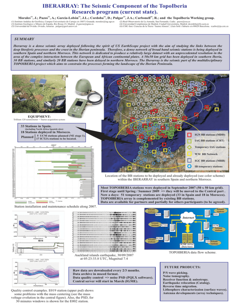
IBERARRAY: The Seismic Component of the TopoIberia Research program (current state). (1) (2) (3) (4) (5) (6) Morales , J.; Pazos , A.; Garcia-Lobón , J.L.; Cordoba , D.; Pulgar , J.A.; Carbonell , R.; and the TopoIberia Working group. (1) Instituto Andaluz de Geofísica, Campus Universitario de Cartuja s/n 18071 Granada. morales@iag.ugr.es (3) Instituto Geológico y Minero de España, Rio Rosas 23, Madrid. jl.garcia@igme.es (5) Universidad de Oviedo, Oviedo, Asturias. pulgar@geol.uniovi.es (2) Real Observatorio de La Armada, San Fernando, Cadiz. pazos@roa.es (4) Universidad Complutense de Madrid, Ciudad Universitária, Madrid. dcordoba@fis.ucm.es (6) CSIC-Inst. Ciencias de la Tierra “Jaume Almera”, Lluís Solé i Sabarís s/n 08028 Barcelona. rcarbo@ija.csic.es SUMMARY Iberarray is a dense seismic array deployed following the spirit of US EarthScope project with the aim of studying the links between the deep litosferic processes and the crust in the Iberian peninsula. Therefore, a dense network of broad band seismic stations is being deployed in southern Spain and northern Morroco. This network is dedicated to produce a relatively large dataset with an unprecedented resolution in the area of the complex interaction between the European and African continental plates. A 50x50 km grid has been deployed in southern Iberia, 30 BB stations, and similarly 20 BB stations have been deloyed in northern Morroco. The Iberarray is the seismic part of the multidisciplinary TOPOIBERIA project which aims to constrain the processes forming the landscape of the Iberian Peninsula. EQUIPMENT: Trillium 120 seismometer + Taurus acquisition system 33 Stations in Spain. (including North Africa Spanish sites) 18 Stations deployed in Morocco. Planned 5 UCM stations planned (NE stage 1). IGN BB stations (MDD) 17 ICTJA stations to be located. IAG BB stations (CRT) Temporary IAG stations WM BB Network IGC BB stations (MRB) IB temporary stations Location of the BB stations to be deployed and already deployed (see color scheme) within the IBERARRAY in southern Spain and northern Morroco. Most TOPOIBERIA stations were deployed in September 2007 (50 x 50 km grid). First stage until Spring / Summer 2009 => they will be moved to the Central part . Now a days: 51 temporary stations are deployed (33 in Spain and 18 in Morocco). TOPOIBERIA array is complemented by existing BB stations. Data are available for partners and partially for others participants (to be agreed). Station installation and maintenance schedule along 2007. Seismic stations IAG Seismic stations ROA Internet Seismic stations ICTJA Seismic stations UCM Seismic stations IGME IGME Server (Data base) Auckland islands earthquake, 30/09/2007 at 05:23:33.8 UTC, Magnitud 7.4 UO Seismic stations TOPOIBERIA data flow scheme. FUTURE PRODUCTS: Raw data are downloaded every 2/3 months. Data archive in mseed format. Data quality control => noise PSD (PQLX software). Central server will start in March (IGME). Quality control examples. E019 station (upper psd) shows some problems with the mass centering (see the mass voltage evolution in the central figure). Also, the PSD, for 30 minutes windows is shown for the E002 station. P/S wave picking. Noise tomography. Receiver function & anisotropy. Earthquake relocation (Catalog). Reverse time migration. Lithosphere characterizaion (surface waves). Antenna developments (array techniques).

