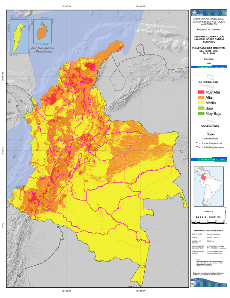
75°0'0"W 81°22'0"W INSTITUTO DE HIDROLOGIA, METEOROLOGIA Y ESTUDIOS AMBIENTALES 13°24'0"N 12°34'30"N 12°34'30"N 13°24'0"N 81°44'0"W Republica de Colombia SEGUNDA COMUNICACION NACIONAL SOBRE CAMBIO CLIMATICO e VULNERABILIDAD AMBIENTAL DEL TERRITORIO 2011 - 2040 a ri b Arch.San Andres y Providencia C 12°29'0"N 81°22'0"W Colombia M a r 81°44'0"W 70°0'0"W 2010 Leyenda 10°0'0"N Leyenda y Convenciones VULNERABILDAD VENEZUELA Muy Alta Alta Media Baja Muy Baja Limites Ocea no P acíf ico 5°0'0"N CONVENCIONES Límite Maritimo Limite Internacional Límite Departamental Mapa de Localización Is. Malpelo AMERICA Escala 0°0'0" 60 BRASIL ECUADOR 30 0 1:8.000.000 60 120 INFORMACION DE REFERENCIA Conforme de Gauss DATÚM MAGNA - SIRGAS ORIGEN DE LA ZONA BOGOTÁ COORDENADAS GEOGRÁFICAS 4° 35' 46,3215'' Lat.Norte 77° 04' 39,0285'' Long.Oeste COORDENADAS PLANAS 1'000.000 metros Norte 1'000.000 metros Este Elaborado por: Héctor Raul Pabón Méndez Subdireccion de Estudios Ambientales © Prohibida la Reproducción total o parcial sin autozación expresa del Ideam 75°0'0"W 70°0'0"W Km PROYECCIÓN Fuentes: - Segunda Comunicacion Nacional ante la Convencion Marco de las Naciones Unidas sobre Cambio Climatico. - Cartografia Basica IGAC. PERU ³ 180


